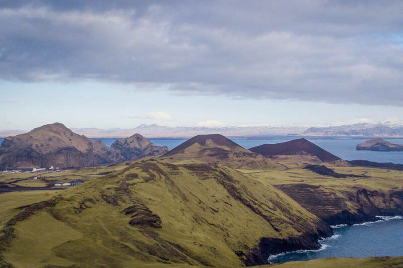
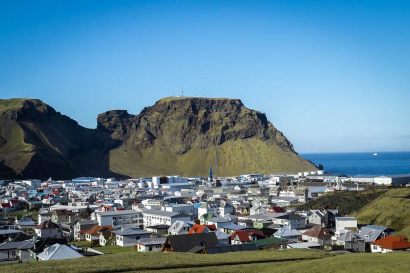
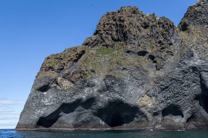
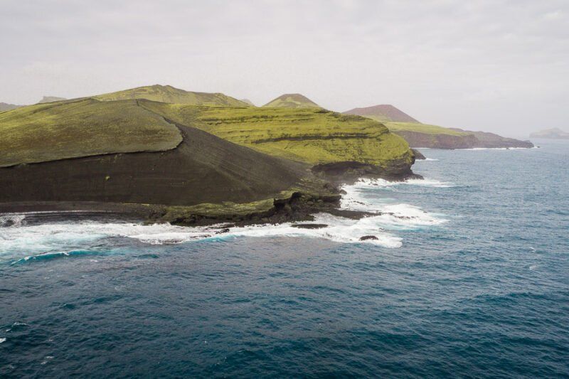
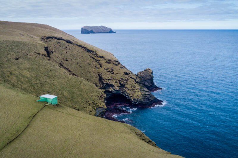
Vestmannaeyjar, also known as the Westman Islands, is an archipelago off the south coast of Iceland. It consists of 15 islands and 30 skerries and sea stacks. Heimaey (“Home Island”) is the only settlement on Vestmannaeyjar that is inhabited year round.


The earliest sources on Vestmannaeyjar are from none other than Landnámabók (Book of Settlements), from the account of Ingólfur Arnarson, Iceland’s first settler. The book tells of how Ingólfur threw his high seat pillars overboard and vowed to settle wherever the gods brought them to shore, which eventually led him to Reykjavík. But before he made the terrible blunder of settling in Reykjavík, he spent one winter on Ingólfshöfði, a cape on the south coast. From there he set out in search of the pillars, but along the way he came across the body of his brother, Hjörleifur.


Hjörleifur had been slain by his Irish slaves, who Ingólfur spotted heading in the direction of the islands south of Landeyjar. At this time the Norse people referred to the Irish as “west men,” and therefore the islands were named Vestmannaeyjar (the Westman Islands). Ingólfur pursued the slaves and slaughtered them. These killings left such a big impression that many places around the archipelago are christened in their honor: Helgafell is named for Helgi, who was from there, and Duftþekja on Heimaklettur is named after the slave Duftþaki, because he was said to have jumped off when Ingólfur was trying to chop him.


The first settler of Vestmannaeyjar, however, was Herjólfur Bárðarson, who lived in Herjólfsdalur valley. In fact, he may have been the first person to party in Herjólfsdalur. Certainly not the last though, as Þjóðhátíð music festival attendees can attest. Longterm residence in Vestmannaeyjar began around 920; prior to that time no one had wanted to stay there over winter. According to Sturlubók, there was a fishing station on the islands, and indeed the locals have been fishing there more or less ever since.


Up until the 12th century, Vestmannaeyjar was owned by farmers. Just after 1400, the archipelago became privately owned by the King of Norway, and later the King of Denmark. The islands were a special domain and even had their own laws, different from the mainland’s. Some might say its remained this way ever since.


Vestmannaeyjar was property of the Crown throughout the Middle Ages until 1874 and was always the kingdom’s largest source of income. We would like more Icelanders to keep that in mind.


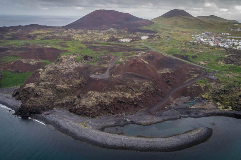
The population of Vestmannaeyjar has taken three large blows over the centuries. First, the population was halved when about 300 people were captured in the Turkish invasion in 1627. The second was due to a wave of infant deaths in the 18th century. Then in the 20th century, the Heimaey eruption of 1973 led to a mass evacuation, and for a period of six months the population dropped from 5,100 people to a mere 200.


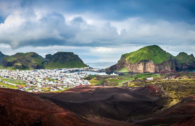
Today, Vestmannaeyjar is home to around 4,300 people, and we’ve never been better.

Places of Interest

Sæfell
19 Jan, 2021
Sæfell is the northernmost mountain in the southern cliffs of Heimaey. Some puffin hunting takes place there when permitted. To the north of Sæfell is the airport. It’s possible to hike up Sæfell, and it’s considered to be one of Heimaey’s easier mountain hikes.
Klif
19 Jan, 2021
Klif is the name of two mountains on the northern cliffs of Heimaey, Stora-Klif and Litla-Klif (“Big Cliff” and “Little Cliff”). It’s possible to hike up Stóra-Klif, but the route can be very challenging so it’s important ask locals for advice before attempting it. Stóra-Klif is located to the north east of Litla-Klif. It is also taller and broader. Both mountains are tuyas but the rocks are considerably looser than, for example, Heimaklettur. The cliffs both have a flat top.
Krossinn
19 Jan, 2021
In the center of Eldfell’s crater stands a large wooden cross. The cross was erected for two reasons: on the one hand to thank the Higher Power that the eruption was not worse, and on the other to commemorate Jón Trausti Úranusson, who died in a digging accident in 1993 when he was working on the volcano.
Stafsnes
19 Jan, 2021
Stafsnes peninsula is one of Heimaey’s most picturesque spots, and the view from there to the outlying islands in the south is quite spectacular. Its at its most beautiful on a late summer’s evening. The peninsula is long and slender, extending out from Dalfell and forming a small fjord. At its base is Stafnesfjara. A trip to Stafnes is well worth the effort, but it’s not the most convenient route. To get there you have to walk from Herjólfsdalur up to Dalfell. From there, you make the steep descent to Stafsnes. The hike up is quite challenging as the slopes are almost vertical at times. Although it may be tempting to go for a swim in this indescribably beautiful spot, people are strongly advised against it as the currents are strong and can be dangerous.
Herjólfsbær
19 Jan, 2021
Herjólfur Bárðarson is considered to be Vestmannaeyjar’s first settler, and Herjólfsdalur valley is named in his honor. In the valley is Herjólfsbær, a turf farmstead that was built in 2005 as a recreation of Herjólfur’s home. Following the most reliable sources, the new farmstead was built as a longhouse with a stable.
Gaujulundur
19 Jan, 2021
In the summer of 1988, married couple Erlendur Stefánsson and Guðfinna Ólafsdóttir began working on revegetating and cultivating on the island’s new lava. It was only 15 years since the eruption, and the soil was pure pumice. Over the years, the grove flourished and it was named Gaujulundur in honor of Guðfinna. Today, the area is full of small trees and shrubs, and it’s well worth a visit.
Fíllinn (“Elephant Rock”)
19 Jan, 2021
Elephant Rock is a cliff face that rises from the ocean and which is part of Dalfell. It’s one of the most popular photo spots in Vestmannaeyjar, as it resembles an elephant drinking from the sea. When you look at it, you can clearly make out a trunk stretching into the water and an alert eye. It’s fun to sail to Elephant Rock to get a close-up view, but you can also see it well from the golf course.
Ræningjatangi and Brimurð
19 Jan, 2021
Páskahellir (“Easter Cave”) is an ideal place to see the rock that formed in the 1973 eruption. It can be found on the eastern side of Eldfell, roughly where the coastline of Heimaey was affected by the eruption. The eruption began on January 23 and finished on July 3 the same year. The cave appeared on Easter and was named accordingly. It underwent further changes during the South Iceland earthquakes of 2000. The locals have a tradition of walking together on Easter and visiting Páskahellir, among other places.
The Birdwatching Hut
19 Jan, 2021
At the birdwatching hut at Storhöfði, you can take in the surrounding nature well protected from the wind and rain. The hut is enclosed, but you can open little windows in its side to look out and enjoy the natural surroundings.  The birdwatching hut is a good place to get close to a puffin colony without disturbing it. To get to the hut, you drive up to Stórhöfði and park your car at the first turn. There are steps over the fence, and from there it’s a short walk through a sheep paddock and up to the hut. The local Lion’s Club commissioned the hut in 2005.
Flakkarinn
19 Jan, 2021
Flakkarinn is a large lava chunk that formed in the Heimaey eruption of 1973. It stands on the new lava and is a unique natural pearl with a fascinating history. The eruption began in January and Flakkarinn was produced by a large explosion in the main crater at the beginning of March. A large boulder then broke away from the northern side of the stratovolcano that had appeared.  This enormous lava chunk floated on top of the lava to the north, traveling at a rate of around 656 feet (200 meters) per day. Thus, it was christened Flakkarinn, which means “The Wanderer.” Some feared that it would float out to harbor and block it, but it stopped just east of Kornhóll due to lava cooling, after having broken into two pieces further south. There’s a viewing platform at Flakkarinn where you can take in the birdlife, mountains, and boat traffic.
Show More

Share by: